Mapping Potential Groundwater Abstraction Hotspots in Irrigated Paddy Fields Using WaPOR-Derived Crop Water Use: A Case Study of UPRIIS Division III
Conference
10th International Conference on Agricultural Statistics
Format: CPS Paper - ICAS 2026
Keywords: groundwater abstraction, philippines, remote sensing
Abstract
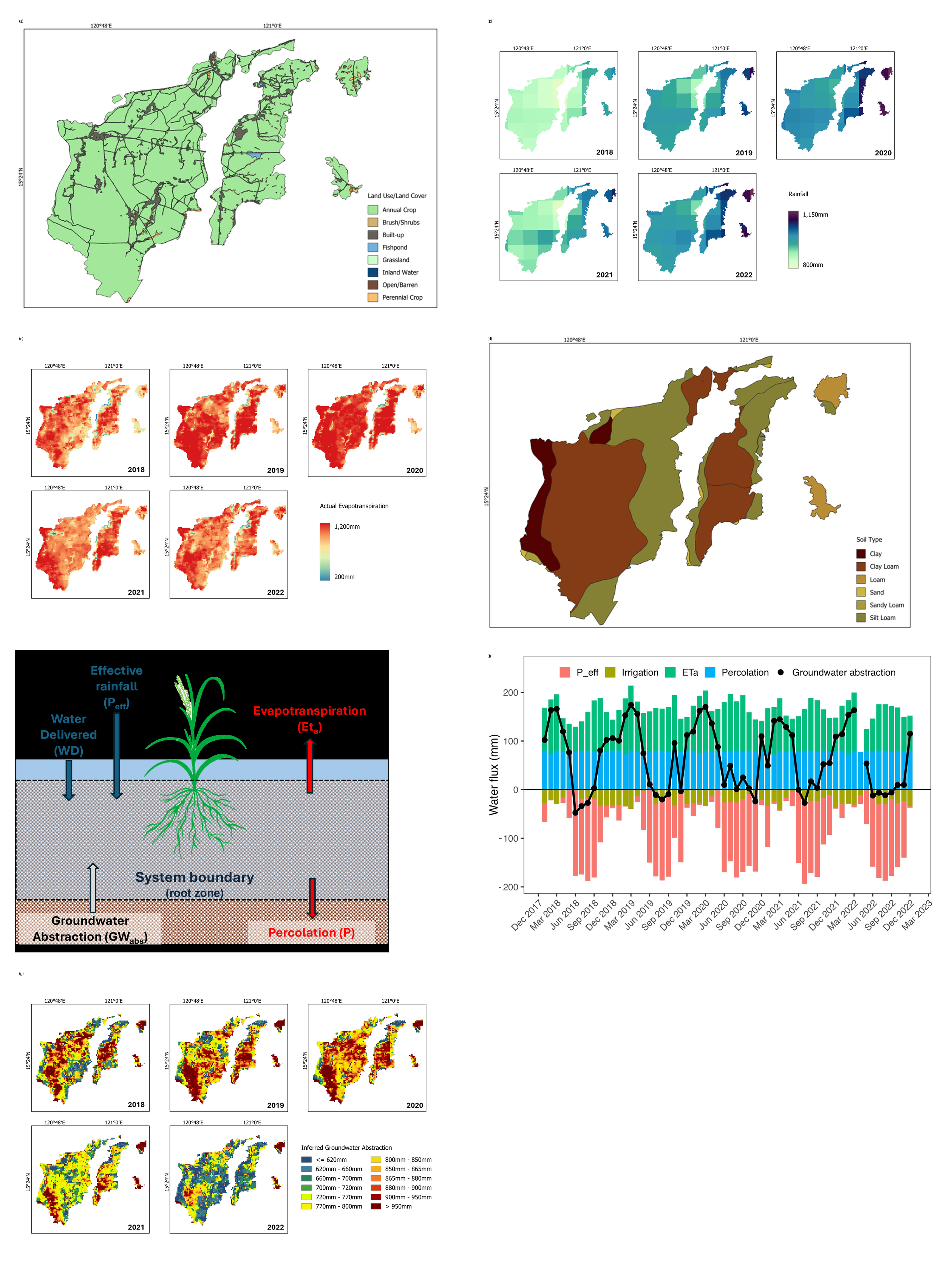
Groundwater has increasingly become a supplemental irrigation source in major rice-producing areas of the Philippines, particularly in UPRIIS Division III, where surface water reliability is affected by seasonal variability and inefficient irrigation infrastructure. This study used a remote-sensing-based framework to address the challenge of monitoring unrecorded groundwater abstraction (GWabs) by applying a simple water balance approach that integrates FAO WaPOR-derived actual evapotranspiration (ETa), CHIRPS rainfall data, irrigation delivery records, and soil-based percolation rates from 2018-2022. Results indicate a seasonal water imbalance, with peak inferred groundwater abstraction occurring during the dry season (November–April). Annual abstraction ranges from approximately 620 mm to 950 mm, with an average of about 780 mm/year. Spatial analysis indicates abstraction hotspots in coarse-soil areas with high ETa. Although large volumes of surface water are delivered to the system, low overall system efficiency resulted in increased dependence on groundwater. Inferred wet-season recharge is not sufficient to offset the dry-season deficit, suggesting a cumulative groundwater stress over time. Overall, the study demonstrates that remote sensing-based water balance can assess groundwater dependency in data-scarce irrigated systems. The identified hotspots can support more targeted groundwater monitoring, improvement of irrigation performance, and planning for sustainable use of both surface water and groundwater resources.
Figures/Tables
Composite_Figure_Galang