Spatiotemporal Analysis of Land Use Change, Vegetation Decline, and Surface Temperature Rise in Nigeria (2004–2024)
Conference
10th International Conference on Agricultural Statistics
Format: CPS Abstract - ICAS 2026
Keywords: "geographic information system, "satellite-data", "spatiotemporal, agriculturalarea, agriculture,, land-cover-classification
Abstract
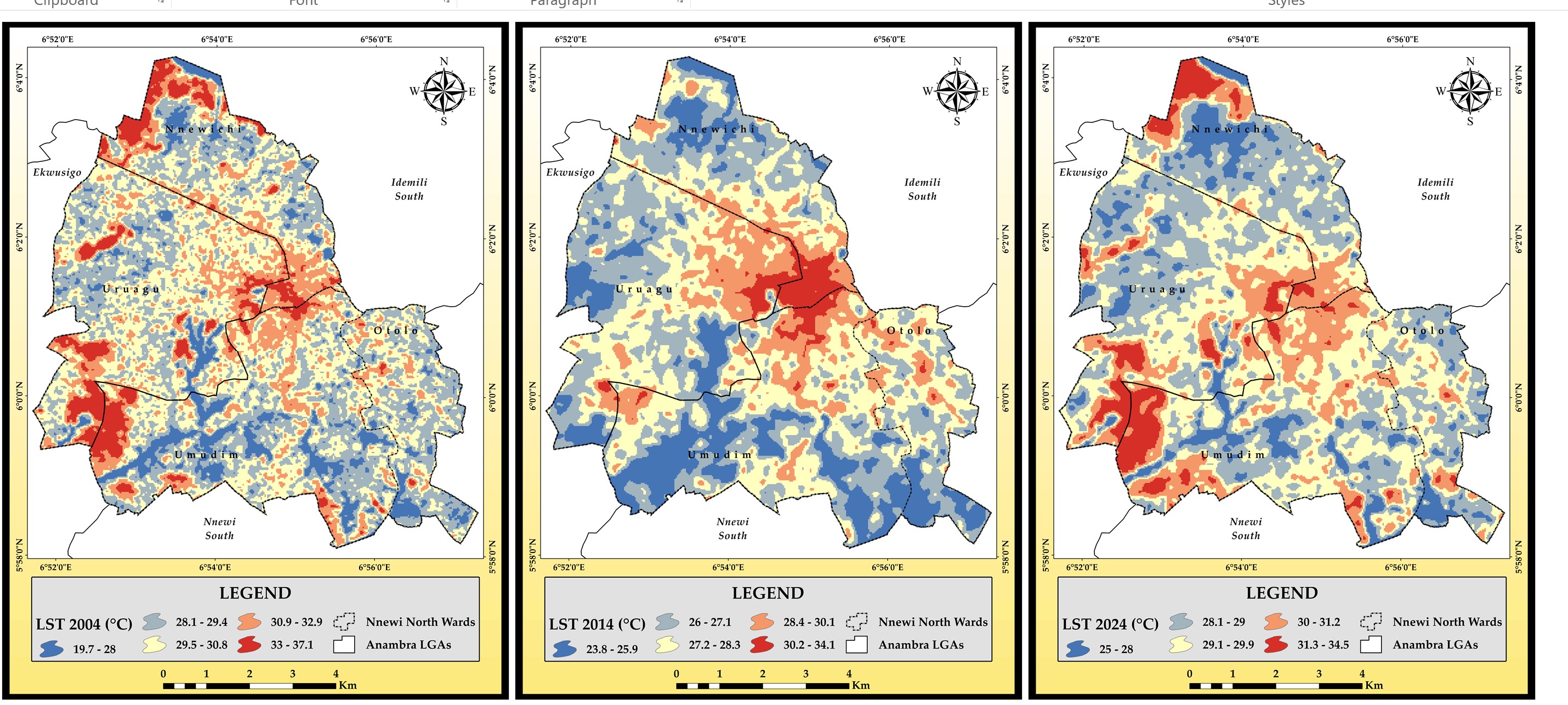
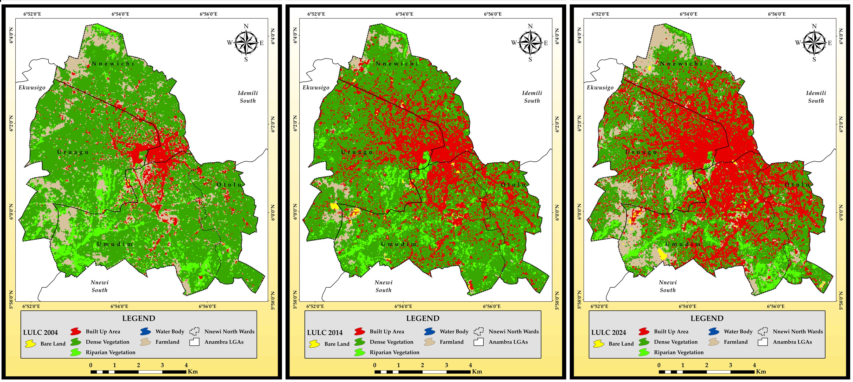
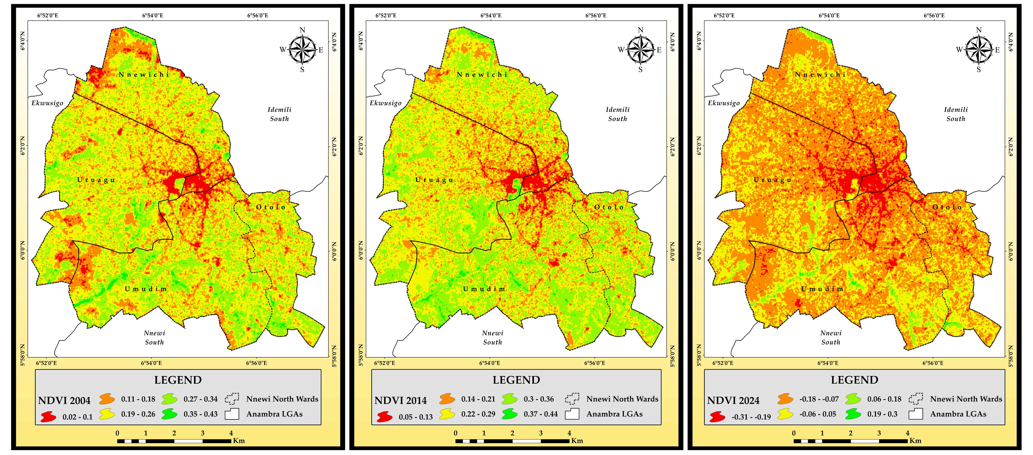
This study presents a geospatial assessment of land use/land cover (LULC) change, vegetation dynamics, and land surface temperature (LST) trends in Nnewi North Local Government Area, Southeastern Nigeria, from 2004 to 2024. Cloud-free Landsat 7 ETM+ and Landsat 8 OLI/TIRS imagery were processed to derive Normalized Difference Vegetation Index (NDVI), retrieve LST via the mono-window algorithm, and perform supervised LULC classification using ArcGIS.Six major LULC classes were identified: Water Bodies, Built-up Areas, Bare Land, Dense Vegetation, Farmland, and Riparian Vegetation. Between 2004 and 2024, built-up areas increased dramatically from 5.96% to 25.22%, while dense vegetation declined from 45.79% to 30.32%. NDVI values revealed a steady degradation in vegetation health, with mean NDVI dropping from 0.25 in 2004 to 0.10 in 2024. In parallel, mean LST values rose from 27.2°C in 2004 to 29.8°C in 2024, underscoring the urban heat impact of vegetation loss.This study highlights the interconnected effects of land cover transformation and urban expansion on local microclimate. By integrating satellite imagery with geospatial techniques, the research offers evidence-based insights to guide sustainable land management, urban planning, and environmental policy in Sub-Saharan Africa.
Keywords: Agriculture, Land Use/Land Cover (LULC), Normalized Difference Vegetation Index (NDVI), Land Surface Temperature (LST), Remote Sensing, Urbanization, Geospatial Analysis
Figures/Tables
LULC 2004 2014 AND 2024
NDVI 2004 2014 2024
LST 2004 2014 2024