Towards Modernizing Rice Yield Statistics in Indonesia: Linking Crop-Cutting Survey with Remote Sensing Data
Conference
10th International Conference on Agricultural Statistics
Format: CPS Paper - ICAS 2026
Keywords: agricultural statistics, crop-cutting survey, remote sensing, rice yield, sentinel-2
Abstract
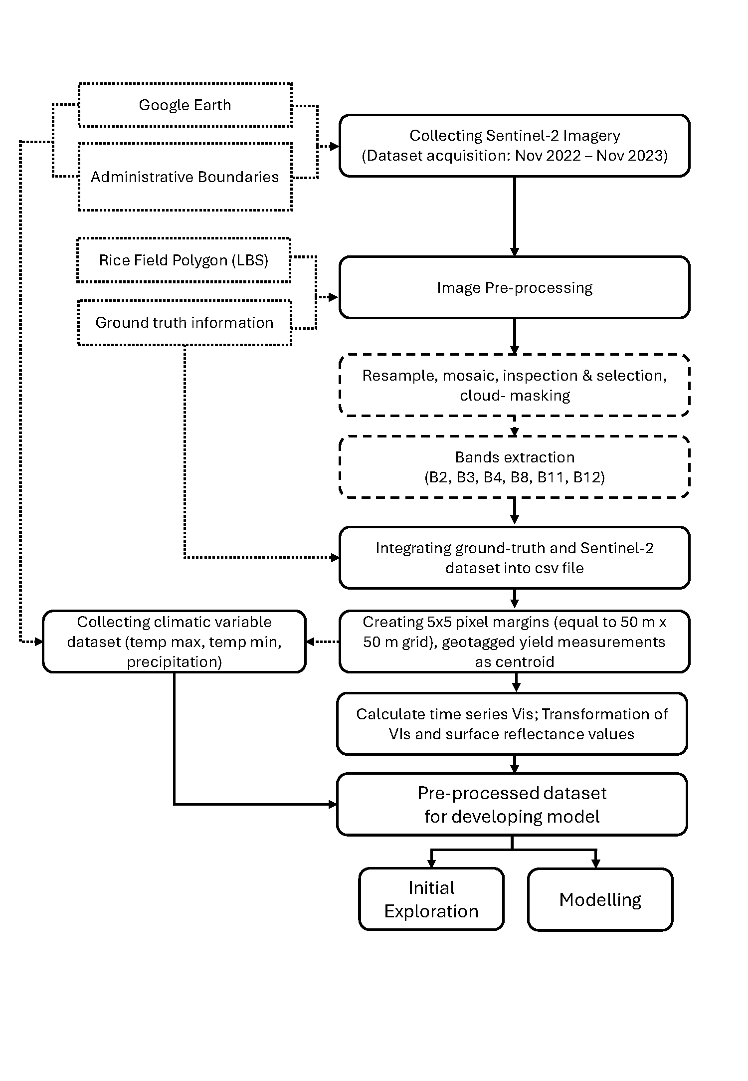
Rice is an essential crop in Indonesia, making accurate and timely rice production statistics critical for agricultural policymaking. Currently, rice yield estimates from Statistics Indonesia (BPS) rely on Crop-Cutting Survey (CCS). Although reliable, CCS is labor-intensive, costly, and subject to delays. Recent advances in Earth Observation (EO), particularly Sentinel-2, offer opportunities to improve efficiency and timeliness of rice yield estimation. This study demonstrates a workflow integrating CCS data with Sentinel-2 imagery and climatic covariates to predict rice yields in Indramayu Regency, a key rice-producing area in West Java, using 2023 CCS samples. Analysis focused on Subround III (September–December) to reduce seasonal variability. Sentinel-2 data were processed to derive vegetation indices within spatial buffers around CCS locations, and Random Forest models were evaluated across harvest months. Results reveal seasonal growth differences and show that models combining peak NDVI and climatic covariates outperformed vegetation indices alone. The study demonstrates a feasible approach for integrating EO into official yield estimation, highlighting both potential and operational challenges.
Figures/Tables
Workflow Diagram_Page_1